AnglingCharts.com

Fishing & Cruising Charts for Lough Corrib

& lakes in the West of Ireland

Traditional and GPS Fishing Maps of Lakes in the West of Ireland


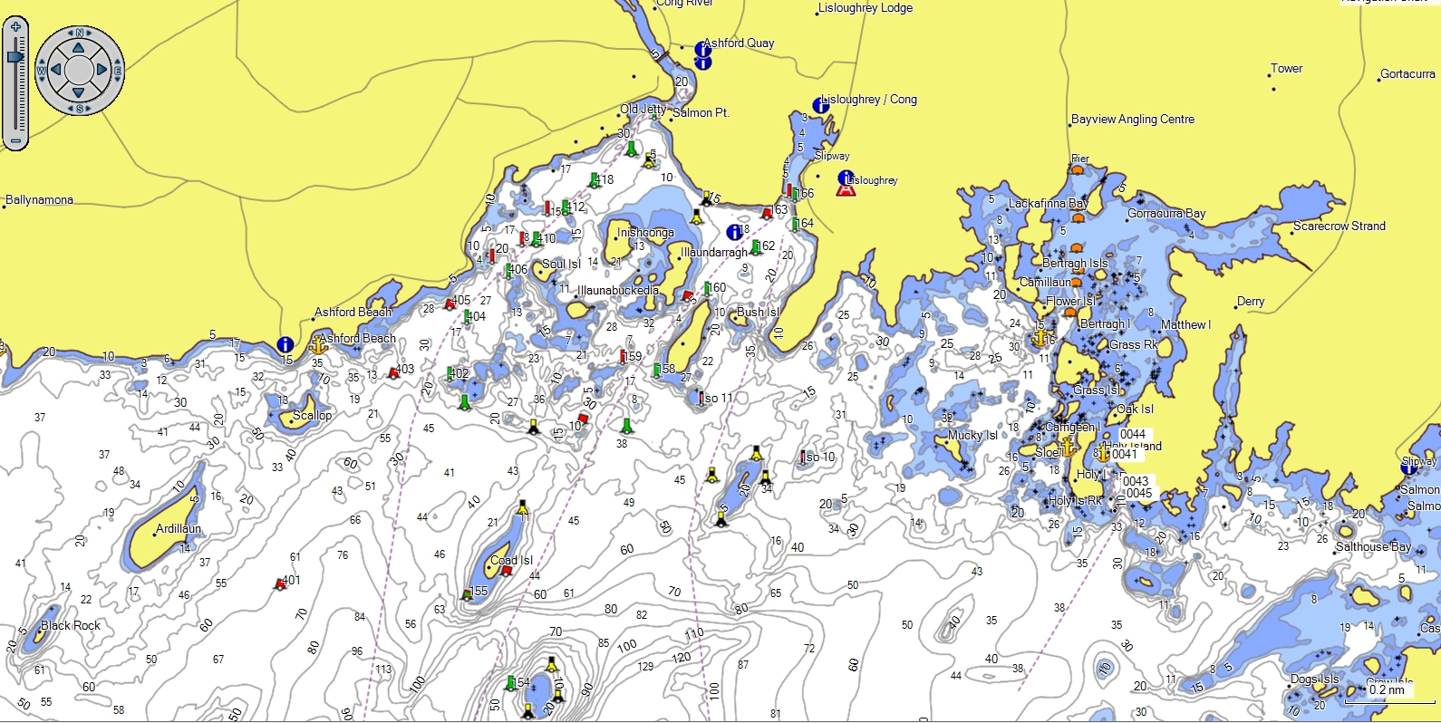
At AnglingCharts I produce cruising charts & fishing maps. I survey lakes and create GPS and paper charts - purely as a non-commercial venture. It's a pastime, much the same as fly fishing is a pastime. Expensive, time consuming, and occasionally very satisfying. It also seems to be becoming quite a geological and archaeological adventure.

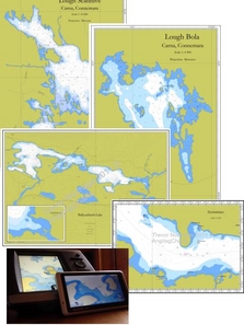
On this website you'll find a growing collection of charts which I can either let you have completely free, or for a small price. There are paper charts of well known boating & fishing lakes, iPad Charts, GPS charts including a free GPS chart of Corrib, some free downloads,  
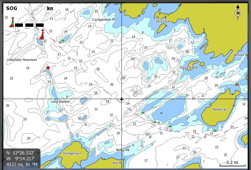
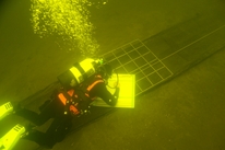
Android charts, lots of interesting "stuff", including wrecks and amazing sidescan sonar imagery, tutorials to help you make your own charts,  and
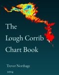
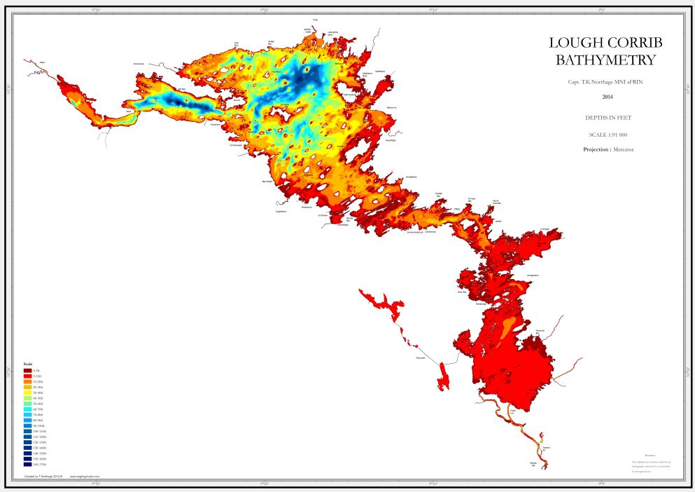
 a Chartbook.


Welcome.


AnglingCharts


Please use the sidebar to explore the website


Charts for most of the lakes and waters on this site are currently available in several forms


  1. Customised charts and fishing maps are available to order. Simply tell us where, and the type of chart you need.

  2. GPS Charts for Lowrance marine units

  3. Apple iPad version


Click on "CHARTS" for details of all available lakes

The latest version of the GPS charts of Lough Corrib are FREE with the purchase of a Corrib Wallchart

Version 2.00 of the GPS Chart of the Corrib is currently available.


The latest development  version (2.05) of the GPS chart now includes LOUGH MASK


This edition 2.00 is a major step forward - now fully contoured from Greenfields to Maam. Contains newly discovered dropoffs and shallows, and the recent historic wreck discovery. As a fishing map the new chart is unbeatable. If you are considering a holiday fly fishing in Ireland, on Lough Corrib, a GPS in your pocket loaded with this chart could take you right to the fish !

Sample and superceded charts (full version) available for FREE download here

It is also available for NUVI

Ancient Dugout Canoe near Oughterard ?

New wreck sidescan images

Apple iPad Corrib Chart NOW available

NEWLY DISCOVERED WRECK OFF CONOR. IMAGERY AND PHOTOS

FREE Corrib Chart in the download section.

Corrib Chart A2 size
Section of The Corrib Chart (A2 size)
Click to Replace
The Corrib Chartbook

Details of the New Navigation Mark system on Lough Corrib

IALA marks for Corrib
IALA Buoyage for Lough Corrib

These are the designs for the new navigation marks on the Corrib. Above are the Main channel (large and small conical buoys with IALA topmarks) and secondary channel marks (can and conical buoys with no topmarks).


Below can be seen the marks they will be replacing. It is important to note that Red circular topmarks will be replaced with GREEN buoys, and Black Diamond topmarks will be replaced with RED buoys. This is entirely in keeping with the IALA standard.


The work will be starting in the near future, public meetings are being scheduled by the Corrib Trustees in order that interested parties can have input.


Click the image for a larger version

Android and iPad users - The latest version of chart is now running on Android and iPad. See screenshots and find out how to get this versatile fishing map  here

Current Charting Projects

Derryclare Lough, Connemara - another world class fishery at the foot of the Inagh Valley, part of the Ballynahinch system. This chart will be available during early spring 2012. The survey is complicated, and the lake rather treacherous.


And of course The Corrib, where a full sidescan survey of the Kilbeg / Knockferry area is planned . This is the site of the lake crossing point for centuries, if not millenia - who knows what's on the bottom ?!


The Shannon Chart project.